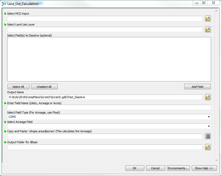
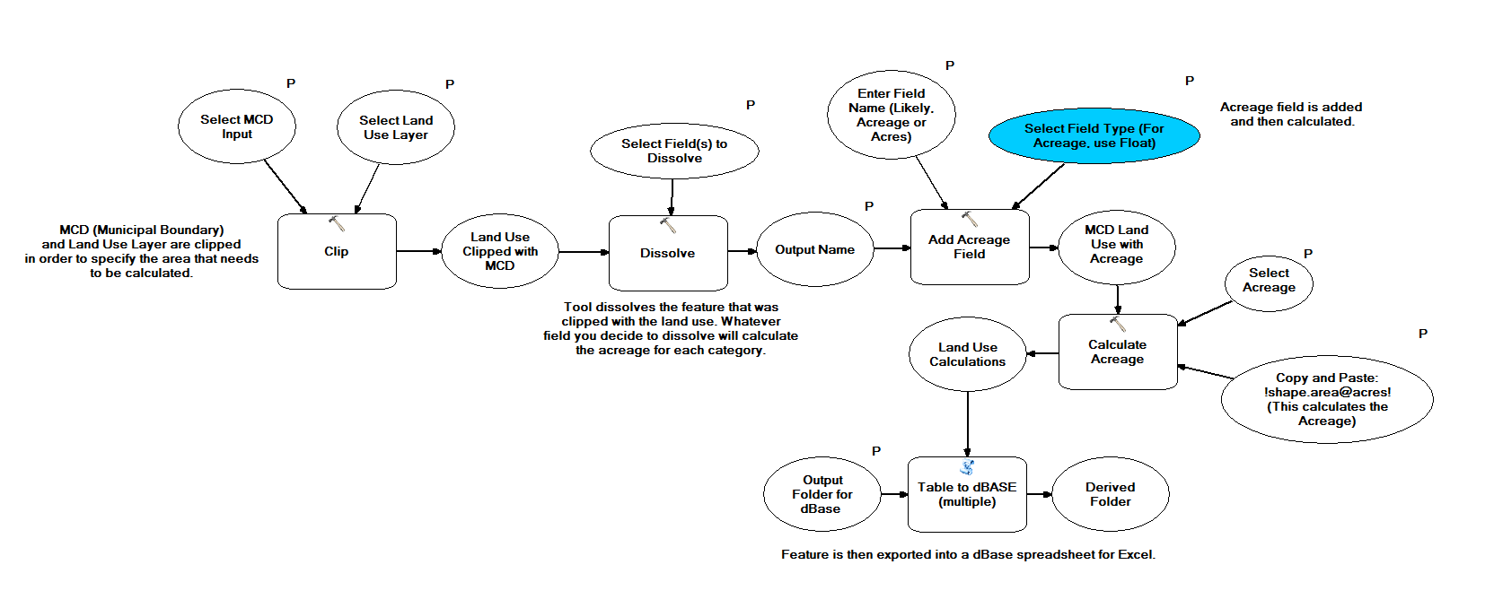
While working for the East Central Wisconsin Regional Planning Commission (ECWRPC), planners collaborated with the many cities, towns, and villages in the 10 counties they represent. Because there are so many comprehensive planning projects throughout these communities, the planning staff at ECWRPC always needed acreage numbers for current and future land use plans.
Thus, I took iniative in developing a ModelBuilder tool that allows anyone in the GIS staff to use. Since not every community has the same data format, the ModelBuilder tool finds the correct land use attribute field in the shapefile to calculate the total acreage of each land use category. With this tool, planners will receive a faster response in acreage numbers when working on comprehensive plans.